
This 10-mile route pairs the Neponset River Greenway with a section of the Boston Harborwalk, beginning at Andrew Station on the Red Line and ending in Mattapan Square. The route can also be reversed and done in the opposite direction.
The Neponset River Greenway is a paved shared-use path following the Neponset River from Boston Harbor to Mattapan. This hidden gem, part of the Department of Conservation and Recreation’s Neponset River Reservation, winds through scenic marshlands, historic neighborhoods, waterfront parks, and serene, wooded landscapes—all just a stone’s throw from Boston’s bustling downtown! Design for the park began in 1991 along a former freight rail right of way, and the trail has been constructed incrementally since then. The newest section, connecting Tenean Beach and Morrissey Boulevard, opened in July 2025. The path is mostly flat and separate from car traffic, making it ideal for cyclists of all levels.
In addition to parking options shown on the map, this route is easily accessible by public transportation. Bikes are allowed on all Red Line trains except during rush hour on weekdays and on off-peak commuter trains as noted on the schedule. Bikes are always allowed on the bus. The T has information about bringing your bike on the system. Bus, subway and trolley options can be paid for with cash, contactless payment by debit card, credit card or digital wallet, or by Charlie Card. Commuter Rail tickets can be purchased on the train, or on the mTicket app.
Getting there:
Red Line: The journey begins at Andrew Station on the Massachusetts Bay Transit Authority’s (MBTA) Red Line, just a 20-minute subway ride from Boston’s downtown.
Getting back:
Bus 30/31: From the Mattapan Station stop, you can take MBTA bus 30 or 31. Buses run every 10-15 minutes and will get you to Forest Hills Station in 20 minutes. From there, you can catch a 15-minute ride back to town on the Orange Line, or if you’re in the mood for more outdoor adventure, check out the Southwest Corridor Park shared use paths, Franklin Park, or Arnold Arboretum, all a short walk from the station.
Mattapan Trolley: If you took a Blue Bike, you can ride the Mattapan Trolley back to Ashmont Station and connect with the Red Line for a 30-minute total trip back into town. Note that bikes are not allowed on the trolley, so this is not an option if you bring your own bike.
Commuter Rail Fairmount Line: For an express option, Blue Hill Ave Station is just up the street from Mattapan Square and is served by the MBTA Commuter Rail’s Fairmount Line. From here you’ll be back to South Station in just 25 minutes. Train frequencies vary based on day and time, so make sure to consult the timetable for your intended travel date.
Bikeshare:
If you don’t have your own bike, Bluebikes can be rented from the dock outside Andrew and can be easily returned to another dock in Mattapan at the end of your ride. Dock locations along the route are shown on the map below, and the full system map can be found in the app.
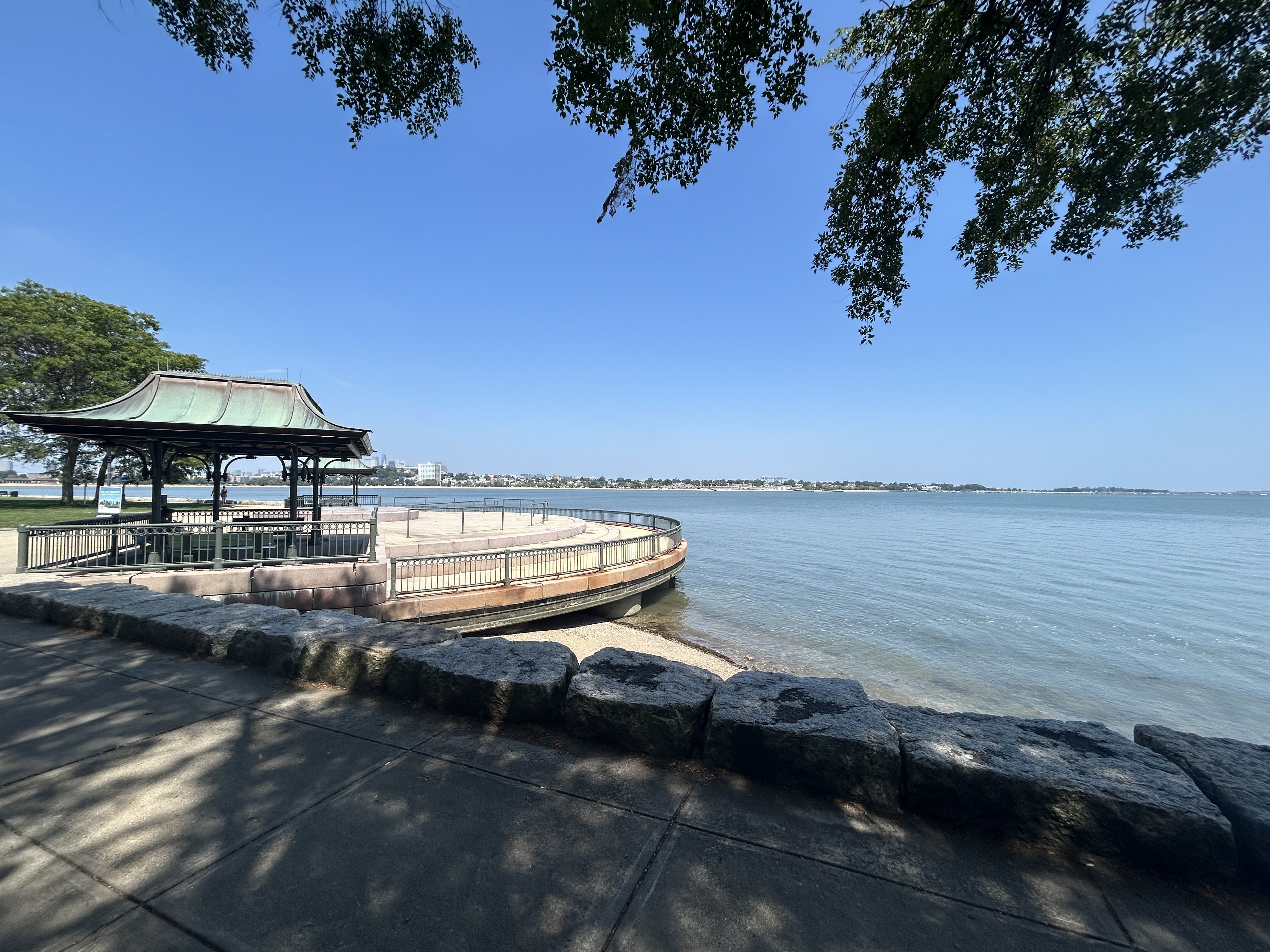
Carson Beach
After passing through Moakley Park, you’ll cross the street to Carson Beach, the largest beach in Boston proper. As you ride along the Harborwalk, enjoy sweeping views of Boston Harbor, and on a hot day, you might be tempted to join local beachgoers for a swim. DCR-run bathhouses offer restrooms, rinse-off showers, and a snack bar, all open from dawn to dusk between Memorial Day and Labor Day.
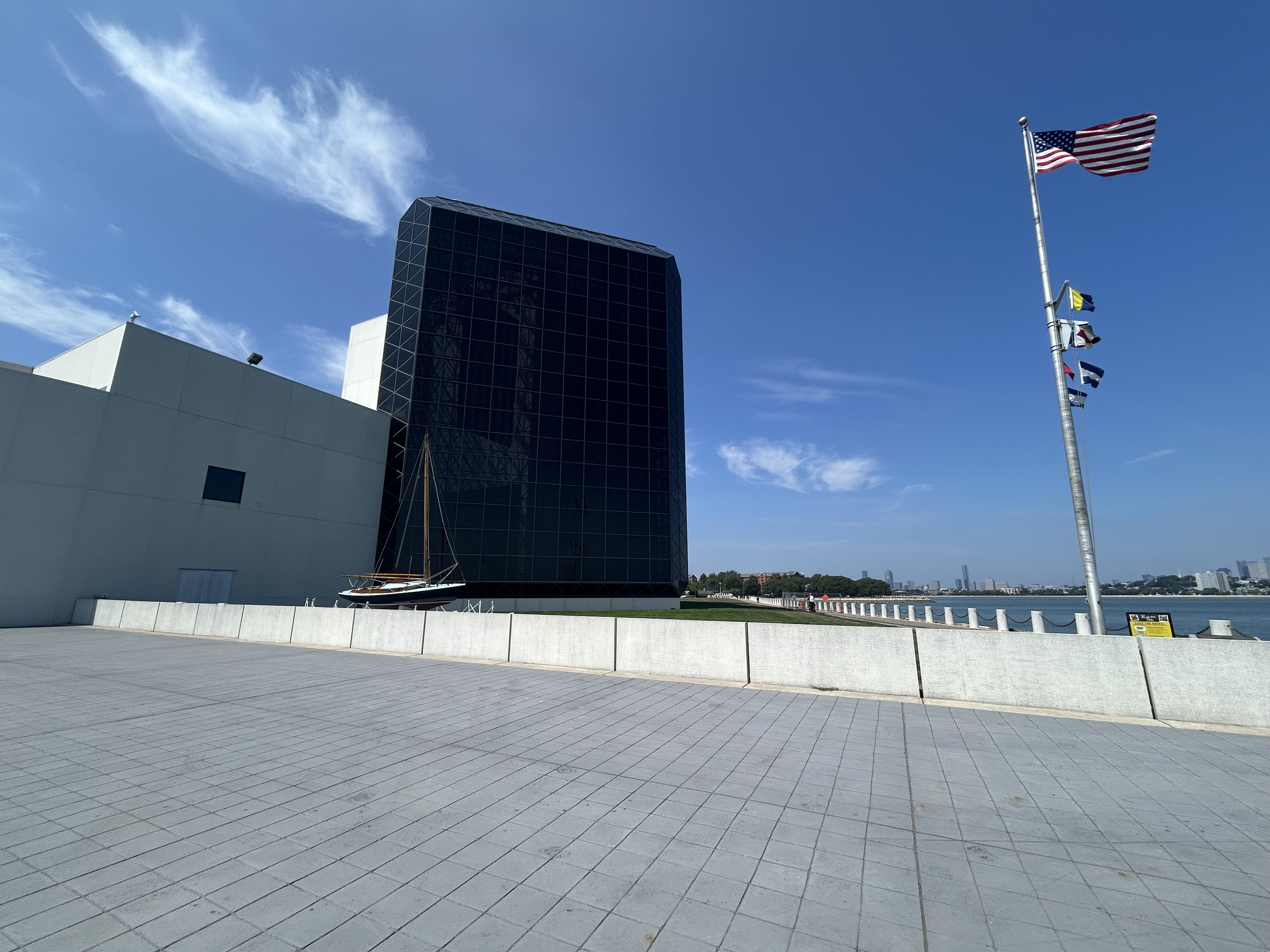
Columbia Point and JFK Presidential Library and Museum
As you continue down the Harborwalk, you’ll ride around Columbia Point and past the campus of UMass Boston. Here you can visit the University Hall Art Gallery, a free museum that hosts rotating exhibitions of local and internationally renowned artists. Next door is the Commonwealth Museum, also free to visit, featuring documents from the Massachusetts Historical Commission’s collection. The third feature attraction on Columbia Point is the JFK Presidential Library and Museum, housed in a building designed by I.M. Pei, the renowned architect behind the Louvre Pyramids as well as a number of projects throughout Boston. Operated by the National Archives and Records Administration, the museum offers a look into JFK’s life, presidency and legacy through multimedia exhibitions and historical artifacts.
Joseph Finnegan and Pope John Paul II Park
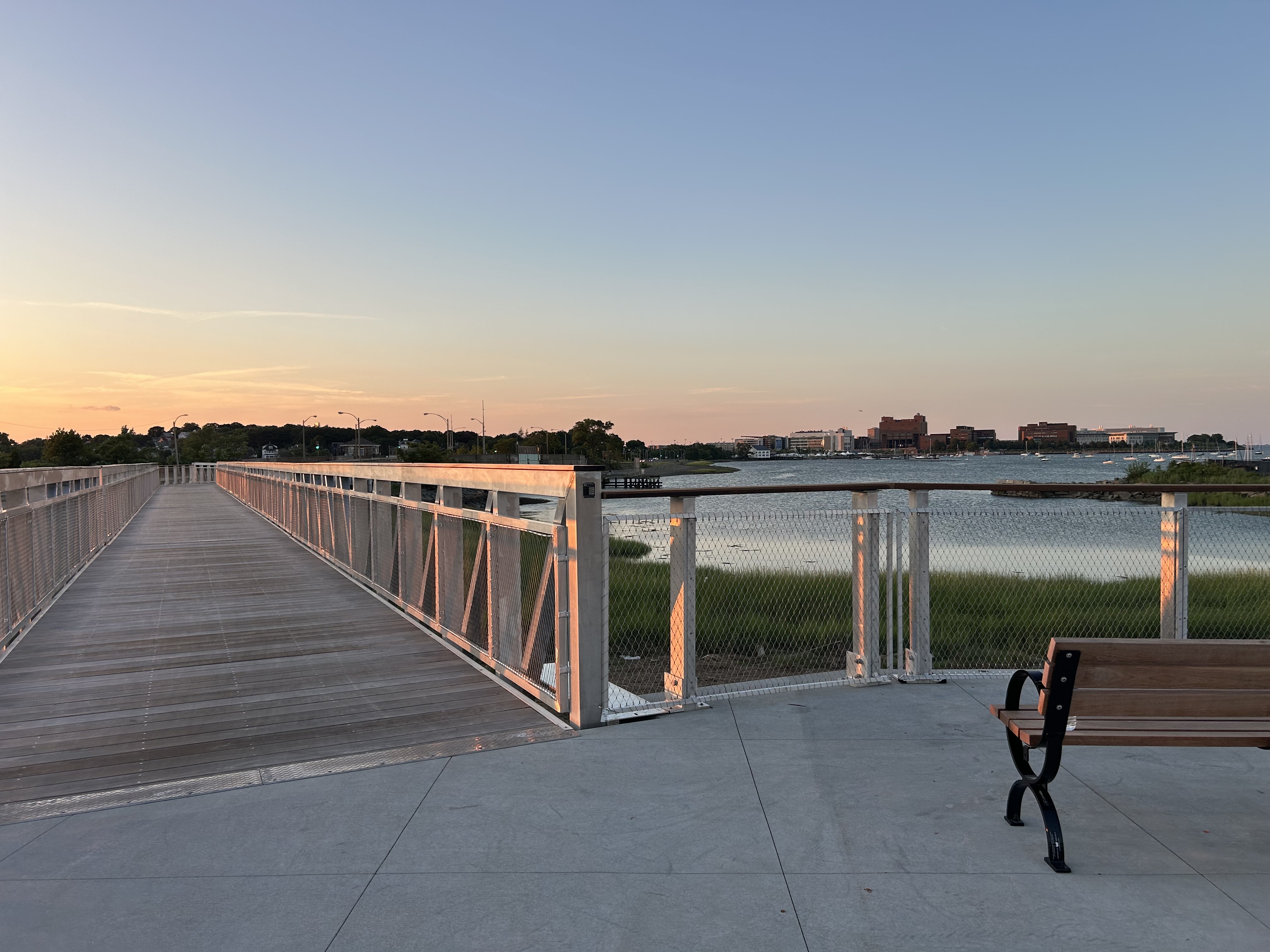
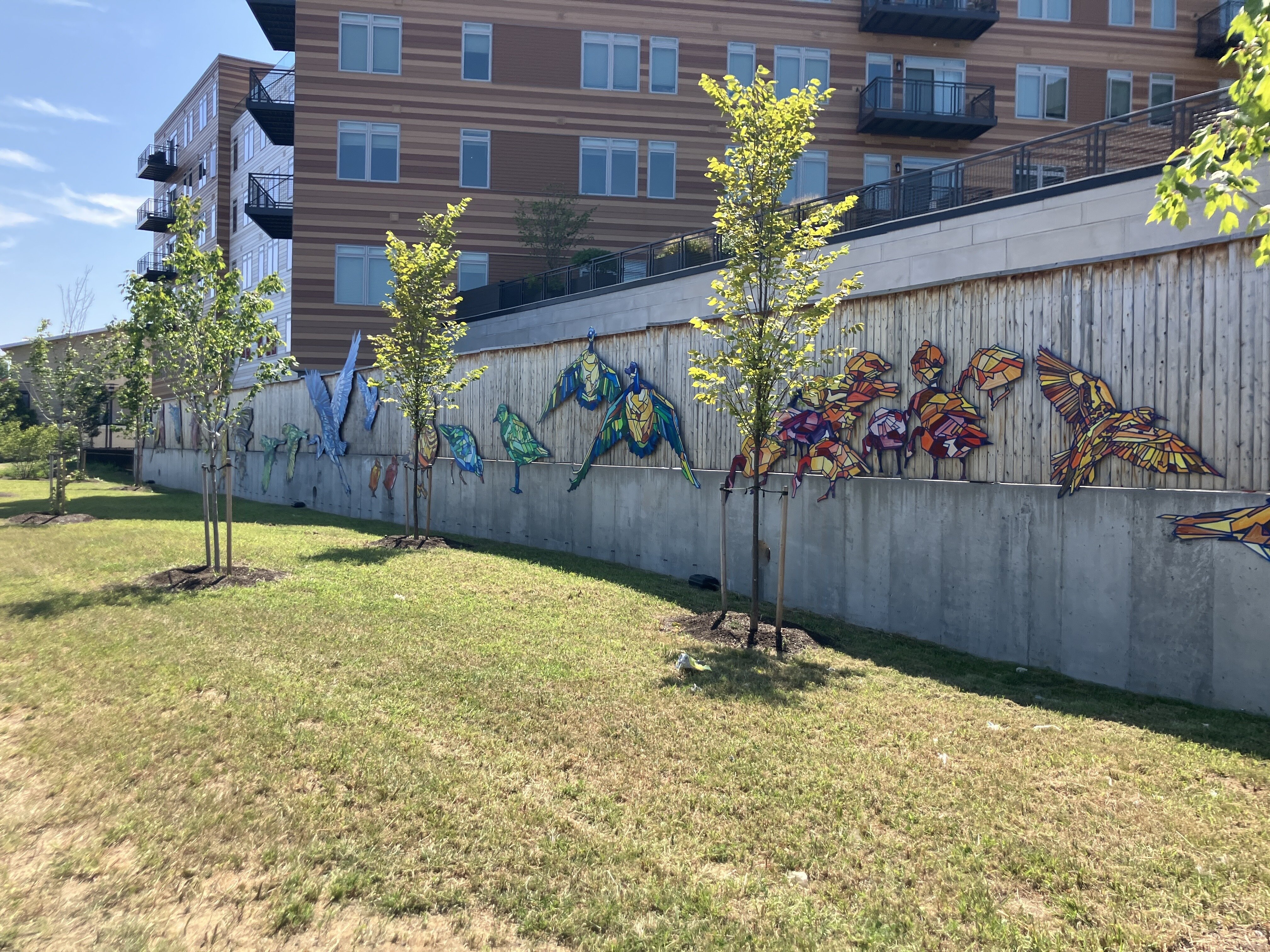
After crossing the newly opened bike and pedestrian bridge and continuing to Tenean Beach, you’ll reach the mouth of the Neponset River and pass through Joseph Finnegan Park and Pope John Paul II Park. This pair of grassy enclaves were constructed upon former industrial sites that DCR remediated and converted into a thriving estuary ecosystem alongside space for active and passive recreation.
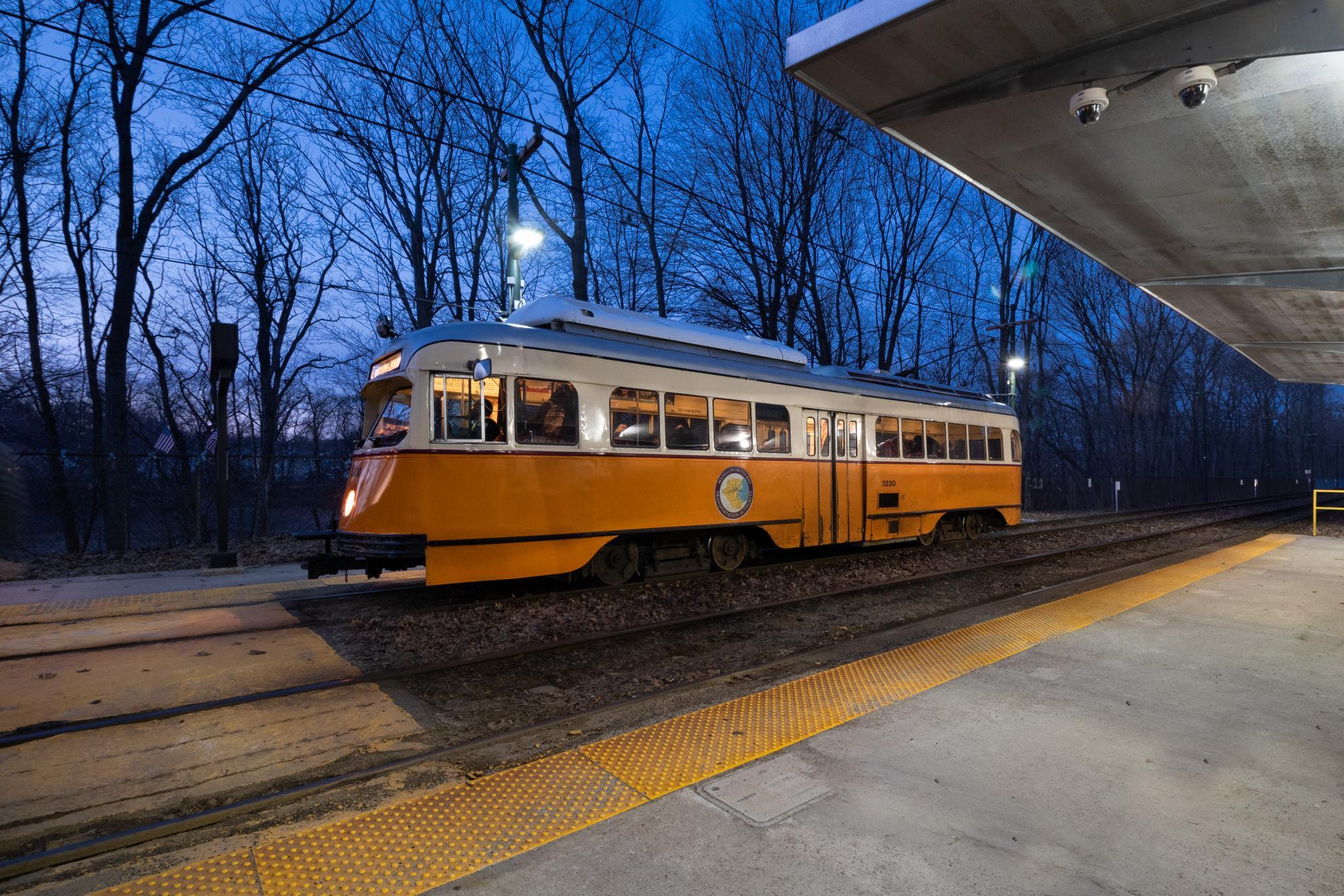
The Mattapan Trolley
Running parallel to the Greenway you’ll likely see the iconic orange and white trolleys cruising along the Mattapan Line. Although technically designated part of the Red Line, the Mattapan Trolley is a standalone light rail line that runs from Ashmont to Mattapan. The rail corridor was originally constructed in 1872, running steam engine commuter trains as part of the Old Colony Railroad’s Shawmut Branch. In 1929, the line was converted to an electric trolley by the Boston Elevated Railway (BERy) and was eventually inherited by the MBTA.
The PCC Trolley Car
The Mattapan Line currently runs PCC trolleys, a vehicle that once graced the streets of nearly every major American city. The PCC was a model of trolley named after the Presidential Conference Committee, a coalition of American streetcar companies that set out in 1936 to design an elegant, high performing standardized trolley to compete with growing popularity of personal automobiles. Boston once boasted an extensive fleet of 321 PCCs built during the mid-1940s that operated on streetcar lines throughout the city. The six serving the Mattapan Trolley are some of the last in the world still in service today, with Philadelphia and San Francisco also maintaining a small fleet. While some may dismiss the PCC as an obsolete relic, their continuing service is a testament to their exceptional engineering and a reminder of the golden age of American urban transit.
Dorchester-Milton Lower Mills industrial complex
As you continue down the trail you might notice several crumbling dams scattered throughout the river, remnants of the factory complexes that dominated the Neponset River for centuries. Beginning in the mid-1600s, the river’s energy was harnessed to produce paper, gunpowder, copper, and a variety of other goods. In 1765, Walter Baker & Company famously opened America’s first mechanized chocolate mill in what’s known as the Lower Mills section of Dorchester. Today, many of these robust industrial buildings have been repurposed and converted into mixed-use residential and commercial spaces. You can read more about the river’s industrial history here.
Harvest River Bridge
As featured in the trail’s artwork, this 170,000-pound steel bridge was installed in 2016 as a critical link between the Milton and Mattapan sections of the greenway. The name “Neponset” is derived from a Massachusett Tribe word in the Algonquian language family, often translated as “harvest river.” This refers to the annual spring migration of herring and smelts, when the Massachusett people gathered to harvest the fish as they swam upstream from the ocean to spawn in the river’s freshwater.

DCR maintains the Neponset River Reservation and Greenway. This page includes information about all the recreational opportunities in the Reservation and updates about DCR’s projects.
There are also non-profit organizations that support the Greenway. You can learn more about the Neponset River Watershed Association and the Neponset River Greenway Council.