
This featured ride begins in downtown Boston and weaves between the Boston and Cambridge sides of the Greenway, ending near Watertown Square. If you’d like to ride further to Waltham through the Upper Charles River Reservation check out this extended route.
The Department of Conservation and Recreation’s Charles River Reservation is a linear park system that begins in Boston’s urban core and follows the Charles River along both the Boston and Cambridge riverfronts. On the Boston side, the segment between the Museum of Science and the BU bridge is known as the Esplanade, while the entire Greenway is connected by the 23-mile Dr. Paul Dudley Bike Path. Dr. Paul Dudley was a renowned cardiologist who famously treated President Dwight D. Eisenhower, prescribing him regular ‘bike therapy’ to keep healthy following his 1955 heart attack.
Public transportation is highly recommended for this route, with easy access to the Esplanade by all subway lines and convenient bus connections back into the city from Watertown. The T has information about bringing your bike on the system. Subway and bus options can be paid for with cash, contactless payment by debit card, credit card or digital wallet, or by Charlie Card. Commuter Rail tickets can be purchased on the train, or on the mTicket app.
Bikeshare:
If you don’t have your own bike, Bluebikes can be easily rented and returned at several docks along the ride. Dock locations near the route are shown on the map below, and the full system map can be found in the app.
Getting There:
If you’re beginning west of downtown you can hop on the Greenway at any access point along the route. To begin at the start of the ride take the Red Line to Charles/MGH, the Blue Line to Bowdoin, the Orange Line to North Station, or the Green Line to Science Park/West End. Note that bikes are not allowed on the Green Line, so if you choose this option, you’ll want to use Bluebikes.
Getting Back:
Bus 504: MBTA Bus 504 runs from Watertown Yard and takes an express route on the Mass Pike back to Boston, stopping in Back Bay and Downtown. Depending on time of day, the bus runs every 20-40 minutes and takes approximately 20 minutes from Watertown to Downtown Boston.
Bus 71 + Red Line: You can alternatively take the local MBTA bus 71 to its terminus in Harvard Square and connect with the Red Line. The bus runs every 10-15 minutes, and takes 25 minutes to get to Harvard. From there, it’s an 11-minute ride downtown on the Red Line.
Fitchburg Line: If you choose to continue to Waltham, you can take the MBTA Commuter Rail’s Fitchburg Line from Waltham to North Station or to Porter Square in Cambridge, which connects to the Red Line. Trains run every hour on weekdays, and every two hours on weekends; timetables can be found here. From Waltham, it’s a 22-minute train ride to North Station.
Bus 70 + Red Line: Another option if you continue to Waltham is to take the local MBTA bus 70 from downtown Waltham to Central Square and connect with the Red Line. The bus runs every 10-20 minutes on weekend days, and takes approximately 40 minutes to get to Central Square.
.jpg)
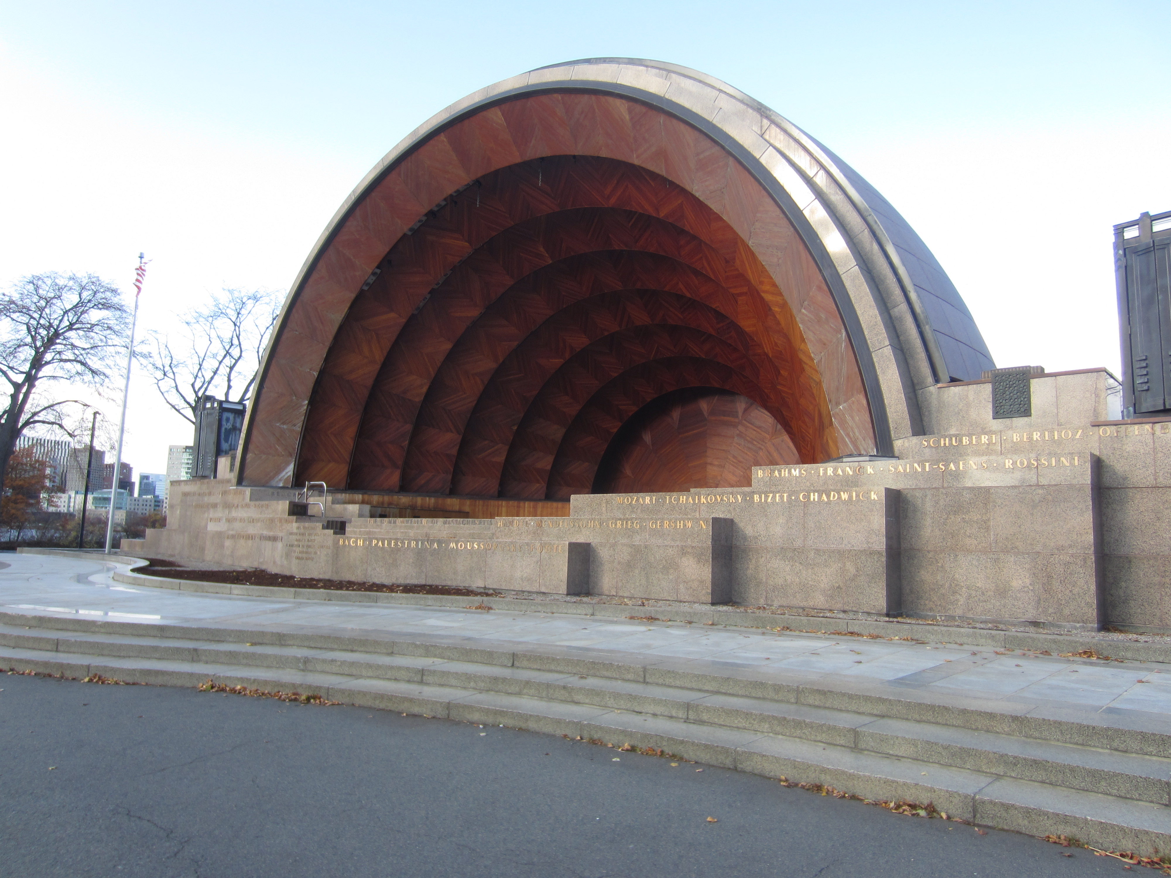
Hatch Shell (0.23 miles from start)
This Art Deco icon, named after its benefactors Edward and Maria Hatch, opened in 1940 as an outdoor concert venue on the Esplanade. The Hatch Shell remains a beloved cultural space for the Boston community, regularly hosting free concerts and movie nights. Learn more about events happening at the Hatch Shell. Be sure to check out the free movie night schedule.
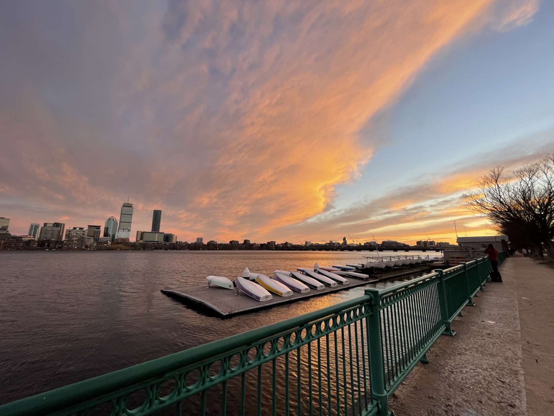
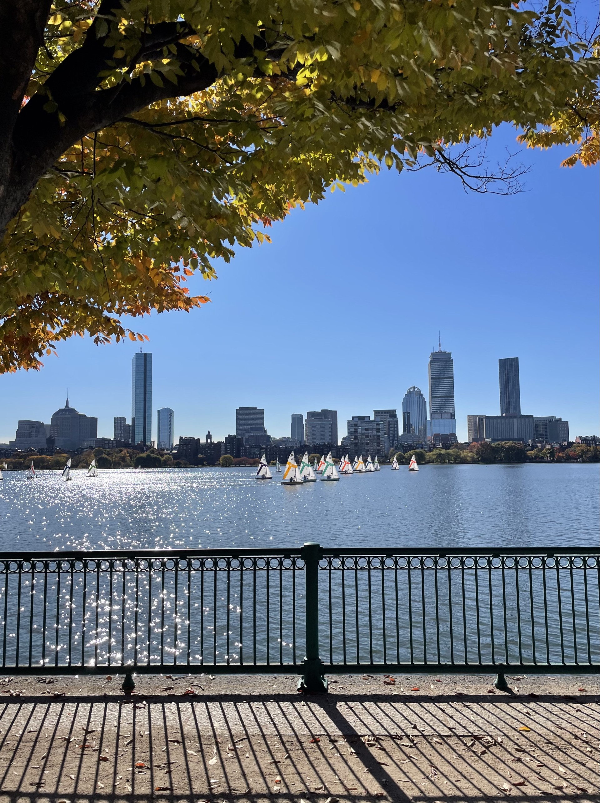
The Esplanade and Storrow Lagoon (0.71 miles from start)
The Esplanade is a popular site for recreation and congregation, home to the Hatch Shell, playgrounds, and a seasonal beer garden. The park was originally constructed in 1910 alongside the Charles River Dam Bridge (today the site of the Museum of Science), which transformed the once tidal Charles River into a freshwater basin, allowing for the riverbank’s development into parkland. In the 1930s, landscape architect Arthur Shurcliffe designed a series of riverside lagoons and three neoclassical granite landings, drawing inspiration from Venice. While the park remains a treasured urban oasis, much of its serenity and accessibility was compromised by the controversial construction of Storrow Drive in 1949. Among the many who objected were Helen and James Storrow, major benefactors of the Esplanade Park and ironically, posthumous namesakes of the road they had adamantly opposed.
Christian Herter Park and Beer Garden (6.1 miles from start)
This Allston park was built in 1974 on the site of the former Charles River Speedway, a late 19th century horse and bicycle racing track. Named after former Massachusetts governor and US secretary of state, Christian Herter, it is the largest section of open parkland along the Charles River. Alongside its small amphitheater, used for community events, the park offers seasonal kayak and paddleboard rentals, as well as a lively beer garden.
Mount Auburn Cemetery (off-trail)
Just off the Greenway, straddling Cambridge and Watertown, is Mount Auburn Cemetery, founded in 1831 as America’s first landscaped cemetery. A certified Arboretum and designated an important bird area by the Massachusetts Audubon Society, the cemetery invites visitors to enjoy its quiet paths and natural beauty. Note that the bikes cannot be ridden within the cemetery.
Harvard Square (off-trail)
A few blocks up the street from the Greenway, you can explore Harvard Square, the site of Harvard University’s primary Cambridge campus and a bustling commercial area. Here you’ll find many options for food and drink, and in addition to walking around the school’s campus, you can check out Harvard’s several free museums, including the Harvard Art Museum and Museum of Natural History.
Arsenal Park (off-trail)
As you approach Watertown, the newly reconstructed Arsenal Park is right across the street from the trail. The park is named after the Watertown Arsenal, originally built in 1816 by the US Army to store ammunition and gradually expanded for continued military use through 1968. In 1995, the park was turned over for civilian use, and in 2025, a major redevelopment of the park was completed, incorporating a world-class playground, community gardens, and a picnic area, in addition to adjacent mixed-use development.
Charles River Museum of Industry and Innovation (at end of extended route to Waltham)
If you decide to continue your ride to Waltham, the Charles River Museum of Industry and Innovation can be found near the end of the trail. Exhibits explore the history of American industrialization with a focus on the local industries and companies that built Waltham into a major manufacturing center. The museum is housed in the former Boston Manufacturing Company’s factory, established in 1813 as the first integrated textile mill in America, meaning that all steps of production were centralized under one roof. Pioneering the ‘Waltham System’ of labor organization, the factory is frequently pointed to as the birthplace of the American Industrial Revolution.
Moody Street (just past end of extended route to Waltham)
Moody Street is a short walk from the end of the trail and serves as a lively, pedestrian-friendly corridor through the heart of Waltham. Once a hub for mill workers and a bustling trolley route, today it offers a wide variety of shops, restaurants, and gathering spaces. Its close proximity to the river and historic downtown make it a perfect spot to relax after your ride.

DCR maintains the Charles River Reservation. This page includes information about all the recreational opportunities along the river and updates about DCR’s projects within the reservation.
Many nonprofit organizations care for and steward the shared-use paths along the river. You can check out the Esplanade Association and the Charles River Conservancy.