
This ride covers the entire completed section of the trail, beginning at Peter Homer Park in South Yarmouth and ending at the Wellfleet Hollow Campground. If you arrive by public transportation on the Cape Flyer or a bus, there is an alternate route that begins at the Hyannis Transportation Center. Note that the initial on-road section to the start of the trail may be uncomfortable for inexperienced riders.
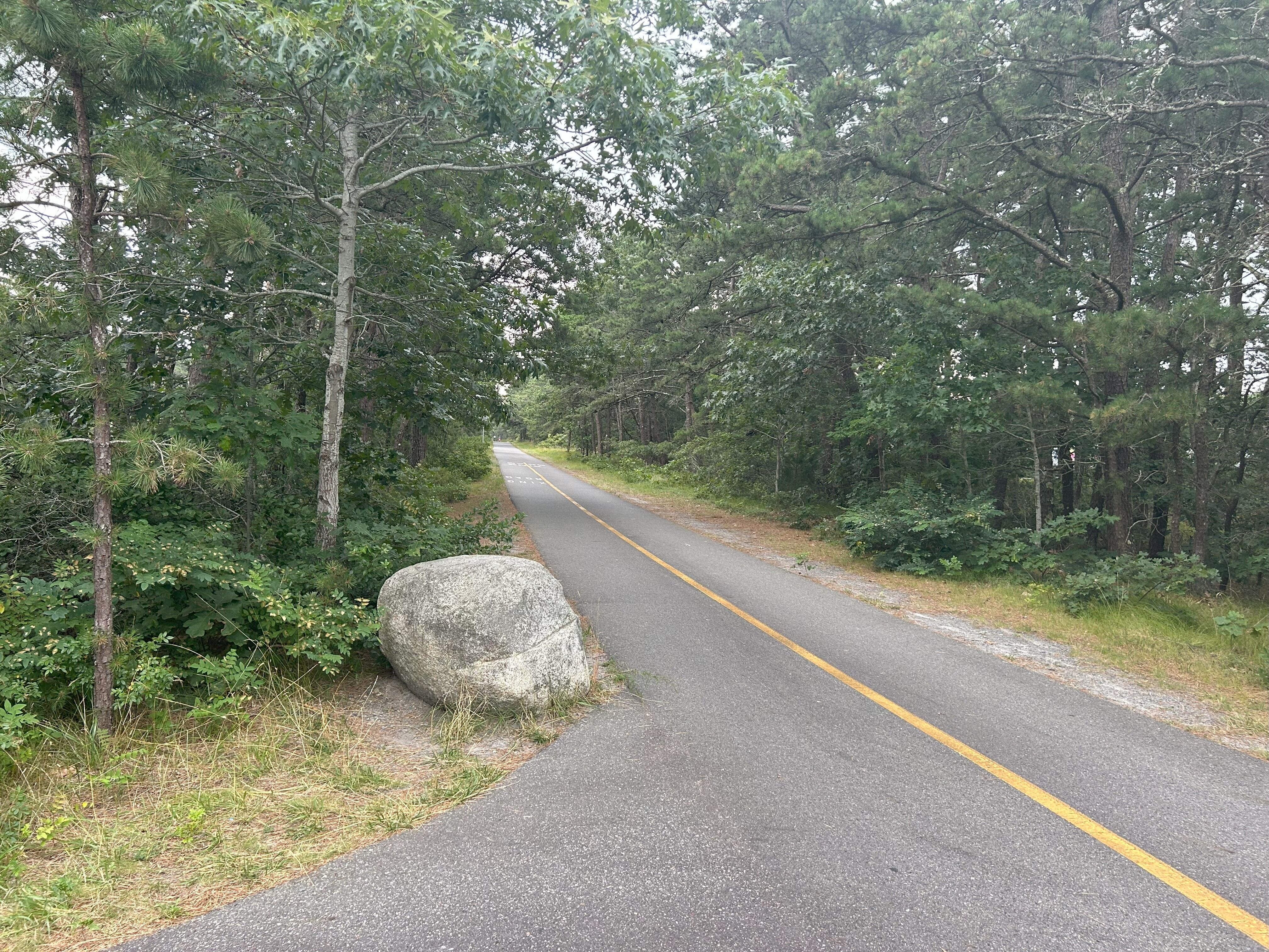
The Cape Cod Rail Trail is a 26-mile path built and operated by the Department of Conservation and Recreation (DCR) that stretches from Peter Homer Park in Yarmouth to Wellfleet Hollow State Campground in Wellfleet. Along the way, it connects to a variety of outdoor destinations including the Cape Cod National Seashore and Nickerson State Park. You’ll also find plenty of dining and shopping options in charming towns along the trail. At the Harwich Bicycle Rotary, you can branch off for a side trip to Chatham by heading east on the Old Colony Rail Trail. The Cape Cod Rail Trail is the best way to experience Cape Cod without the hassle of parking and summertime traffic.
Getting there:
There are several parking lots along the trail, shown on the map below. If you choose to take public transportation, there are multiple carriers with service to the Hyannis Transportation Center. Again, note the on-road section between Hyannis and the trailhead. All Cape Cod Regional Transit Authority (CCRTA) bus routes are currently operating fare-free.
Cape Flyer: The Cape Flyer train runs from Boston twice daily Friday-Sunday from Memorial Day through Labor Day, with additional stops in Braintree, Brockton, Lakeville, Wareham Village and Bourne. The total trip from Boston is around 2.5 hours.
Plymouth and Brockton Bus: Plymouth and Brockton operates an hourly bus service from Boston to Hyannis, with stops in Rockland, Plymouth, Sagamore and Barnstable. The trip is 2 hours and 12 minutes, and schedules can be found on the P&B site.
Peter Pan Bus: Peter Pan also operates a bus route six times daily between Boston and Hyannis, with stops in Rockland, Plymouth, Sagamore, and Barnstable. The ride from Boston takes 90 minutes, and schedules can be found on the Peter Pan website.
Getting Around and Getting Back:
CCRTA H20 Bus: If you’re getting tired and are ready to turn back, you can catch the CCRTA H20 bus from South Dennis, Chatham, or Orleans back towards Hyannis. This route can be handy throughout your journey if you want to explore multiple towns along the trail but don’t feel like biking the whole way.
CCRTA Flex Bus: If you’d like to check out Provincetown but want to avoid biking on-road after the end of the trail, you can take the CCRTA Flex bus from Wellfleet to Provincetown, which runs hourly and takes about 40 minutes. CCRTA provides information about taking bikes on the bus.
Provincetown Ferry: If you came from the Boston area, and want to make your journey into a loop, you can take the high-speed ferry from Provincetown to Boston. The ferry runs 4 times daily, and the trip takes an hour and 45 minutes.
Peter Pan Bus: A state-subsidized Peter Pan route operates three times daily between Provincetown and Hyannis, a 50-minute ride with tickets costing a flat $10 rate. The bus also makes stops in Truro, Wellfleet, Eastham, Orleans and Harwich. Schedules and ticket information can be found on the Peter Pan website.
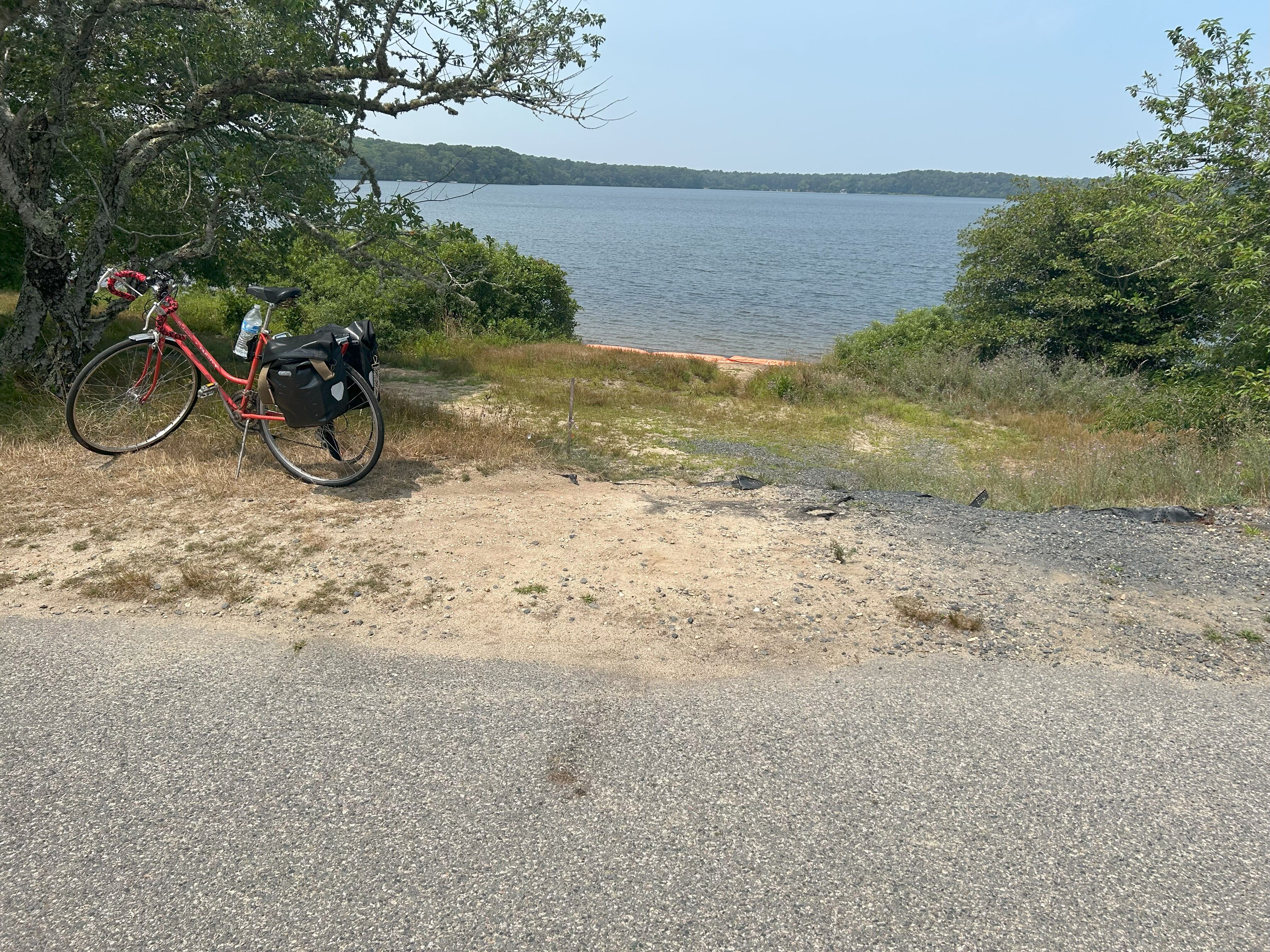
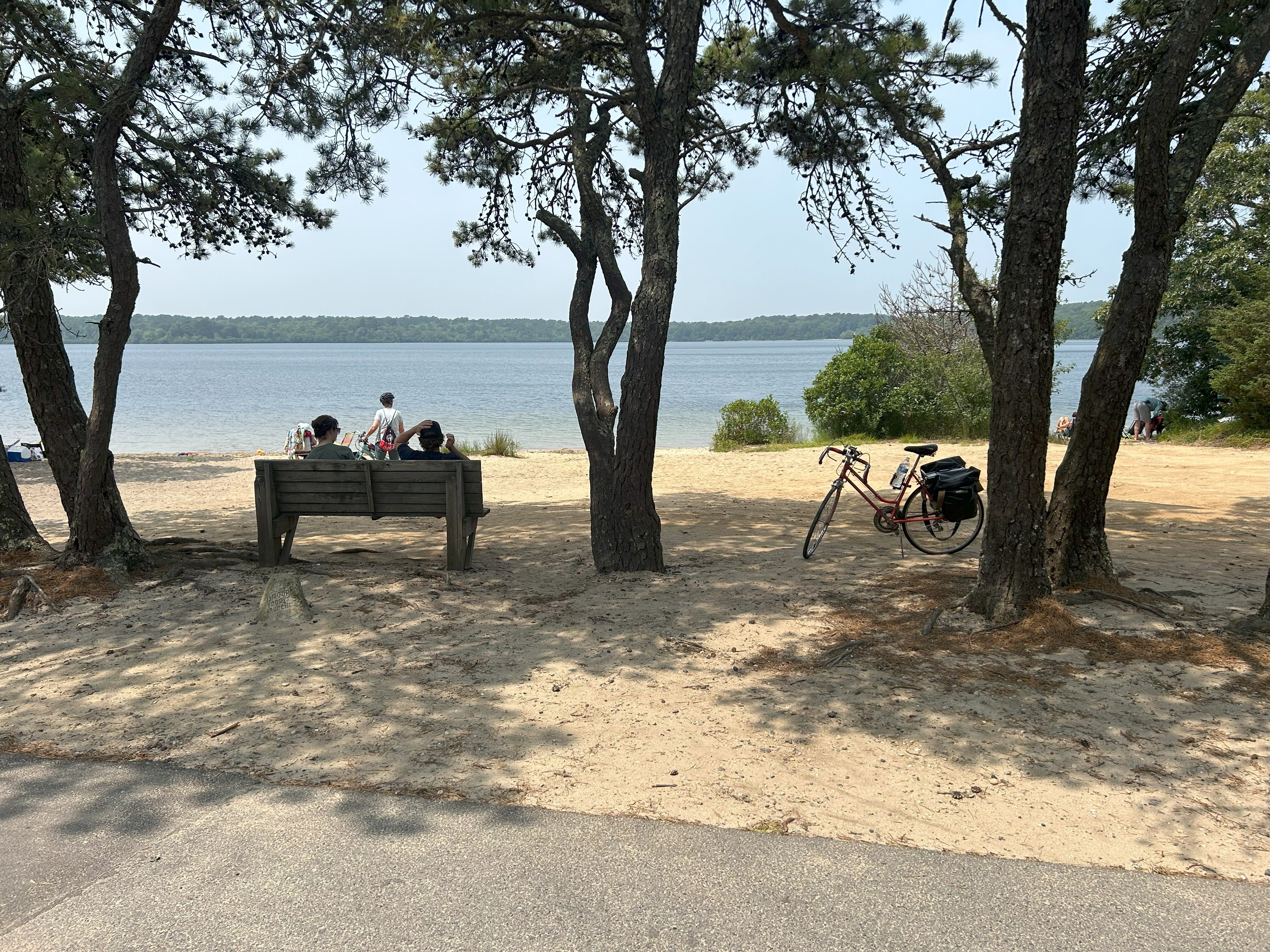
Seymour Pond (9.6 miles from start)
This medium-sized kettle pond is right on the trail in Brewster and has a sandy public beach for swimming. Kettle ponds are a common geological feature along the Cape, formed during the last ice age when giant ice blocks were wedged into glacial sediment deposits, forming ponds as the ice blocks melted. Seymour Pond is connected to neighboring Hinckleys Pond by a canal dug in the 1800s to irrigate a now-abandoned cranberry bog. Today, the canal offers a valuable migration path for blueback herring and alewives.
Nickerson State Park (14.3 miles from start)
Right off the trail in Brewster, Nickerson State Park offers 1,900 acres of forest, ponds and trails perfect for hiking, swimming and fishing. If you want to extend your ride into a multi-day excursion, the park is a great spot to camp, with 400 available campsites. You can check out camping information and make sure to book ahead of time as sites can fill up during peak season.
Orleans (16.8 miles from start)
The trail passes right through Orleans, a picturesque Cape Cod Village with many dining and shopping options. Orleans was incorporated in 1797, splitting from its neighbor, Eastham. During the Revolutionary War, local patriot, Isaac Snow was captured twice by the British and confined to a prison ship in England, before escaping to France. Because of this, residents decided they didn’t want an English name for their town, instead naming it after Louis Philippe II (aka Philippe Égalité), the French Duke of Orléans, and a supporter of America during its war for independence.
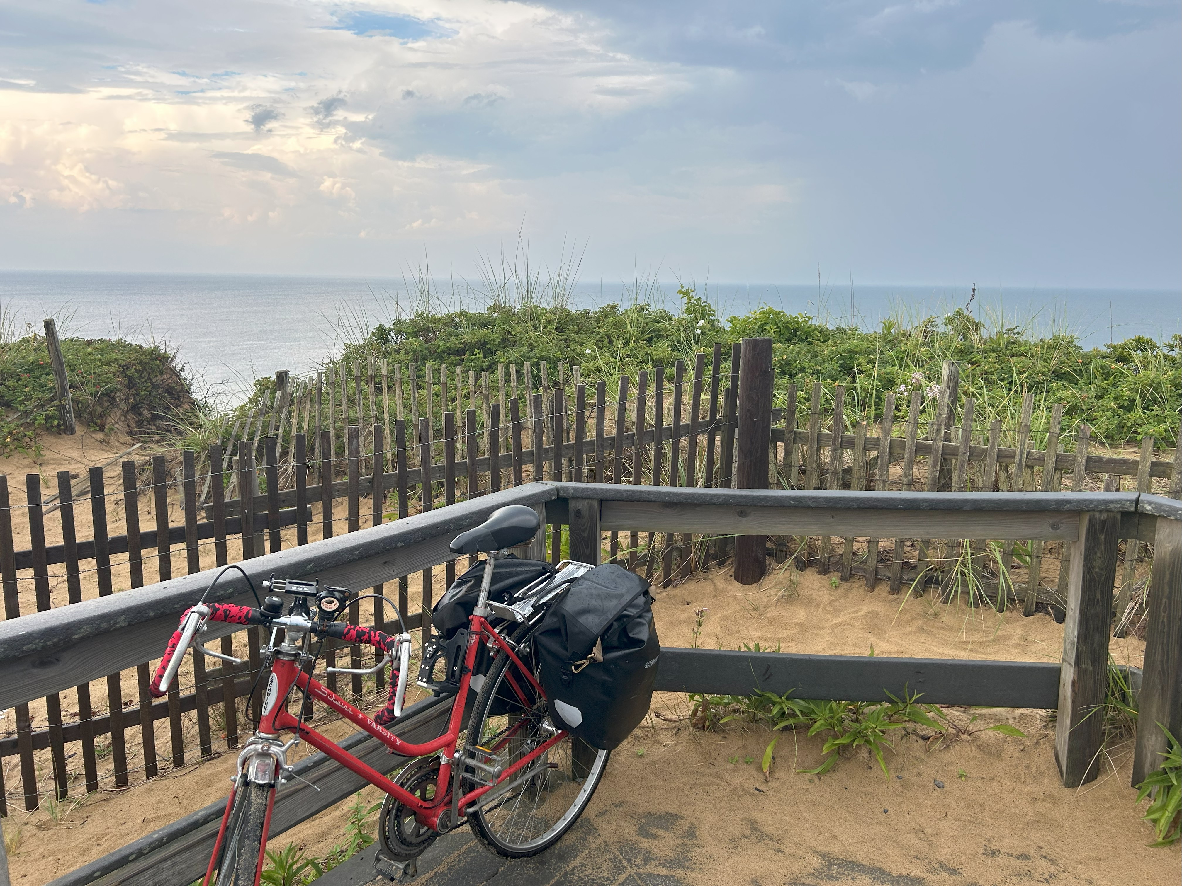
Cape Cod National Seashore (at trail end, 24.9 miles from start)
The Cape Cod National Seashore (CCNS) was established in 1961 by a local resident named John F. Kennedy. The CCNS includes nearly 40 miles of shoreline along the Atlantic-facing coast and is administered by the National Park Service. The Seashore is home to arguably some of the nicest beaches in the country, including Coast Guard Beach and Nauset Light Beach in Eastham, as well as Lecount Beach and Marconi Beach in Wellfleet, all of which are easily accessible off the trail.
Wellfleet Hollow Campground (off-trail)
Right at the northern end of the trail you’ll find another great campground at Wellfleet Hollow. Its 108 campsites are available for up to three nights, with the location providing an ideal base camp to explore the lower Cape and nearby attractions.
Marconi Beach and Marconi Station (off-trail)
Part of the Cape Cod National Seashore, Marconi Beach is a beautiful, ocean-facing beach accessible via a spur near the trail’s end in Wellfleet. The beach was named after Guglielmo Marconi, an Italian electrical engineer and inventor, who in 1903 transmitted the first successful transatlantic wireless communication from a tower North of the beach that’s preserved for visitors to explore. Despite his scientific achievements, he later became a member of the Fascist Grand Council under Benito Mussolini, and during his seven-year tenure as president of the Royal Academy of Italy, not a single Jewish student was admitted.
Nauset Lighthouse (off-trail)
The Nauset Lighthouse was originally constructed in 1877 down the coast in Chatham, before being relocated to its current Eastham location in 1923. The fully automated lighthouse still operates today as a navigational aid and is seasonally open biweekly for tours. The lighthouse is famously featured on the bag of Cape Cod potato chips and is also the star of a special Massachusetts license plate that generates revenue for local community projects.
DCR maintains a website about the Cape Cod Rail Trail. The page includes information about all the recreational opportunities along the trail and updates about DCR’s projects.
There are also local stakeholder groups that support the Trail. You can check out the site of the Friends of the Cape Cod Rail Trail.